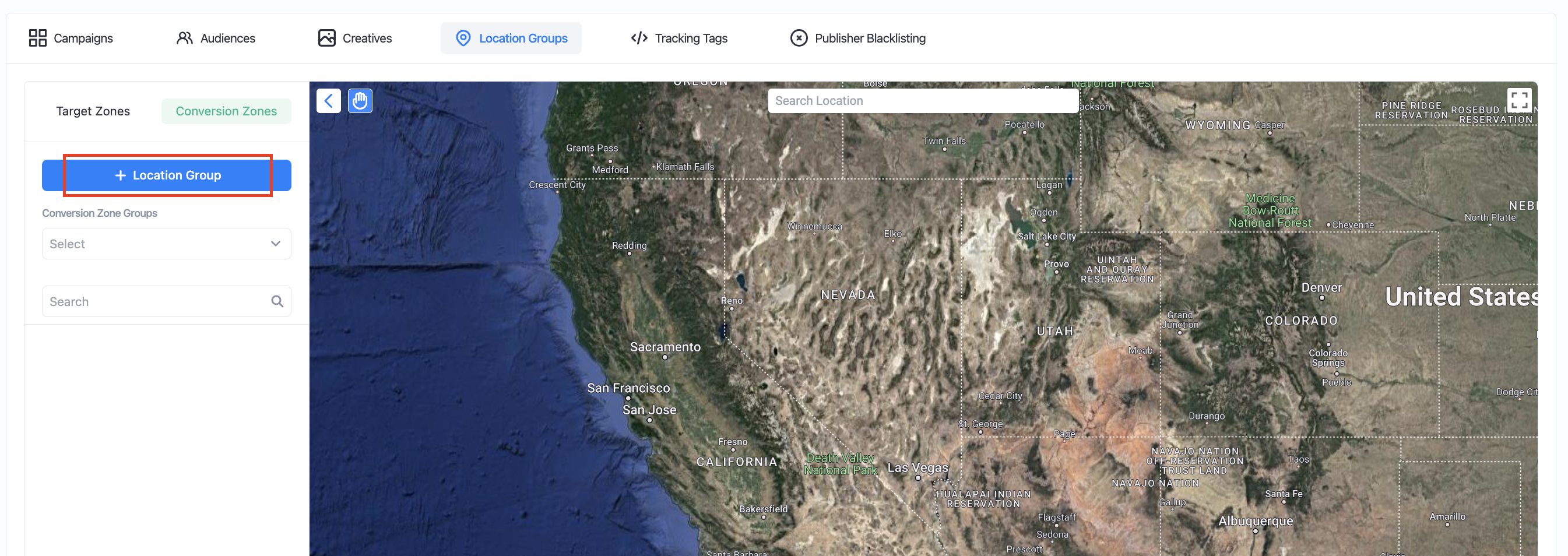
Under the "Location Groups" section of the campaign builder, select the "Conversion Zones" option and select "+ Location Group".
After creating a Conversion Zone Location Group, you may begin drawing a conversion zone on the map by pressing the “Draw Polygon” button on the geofence map.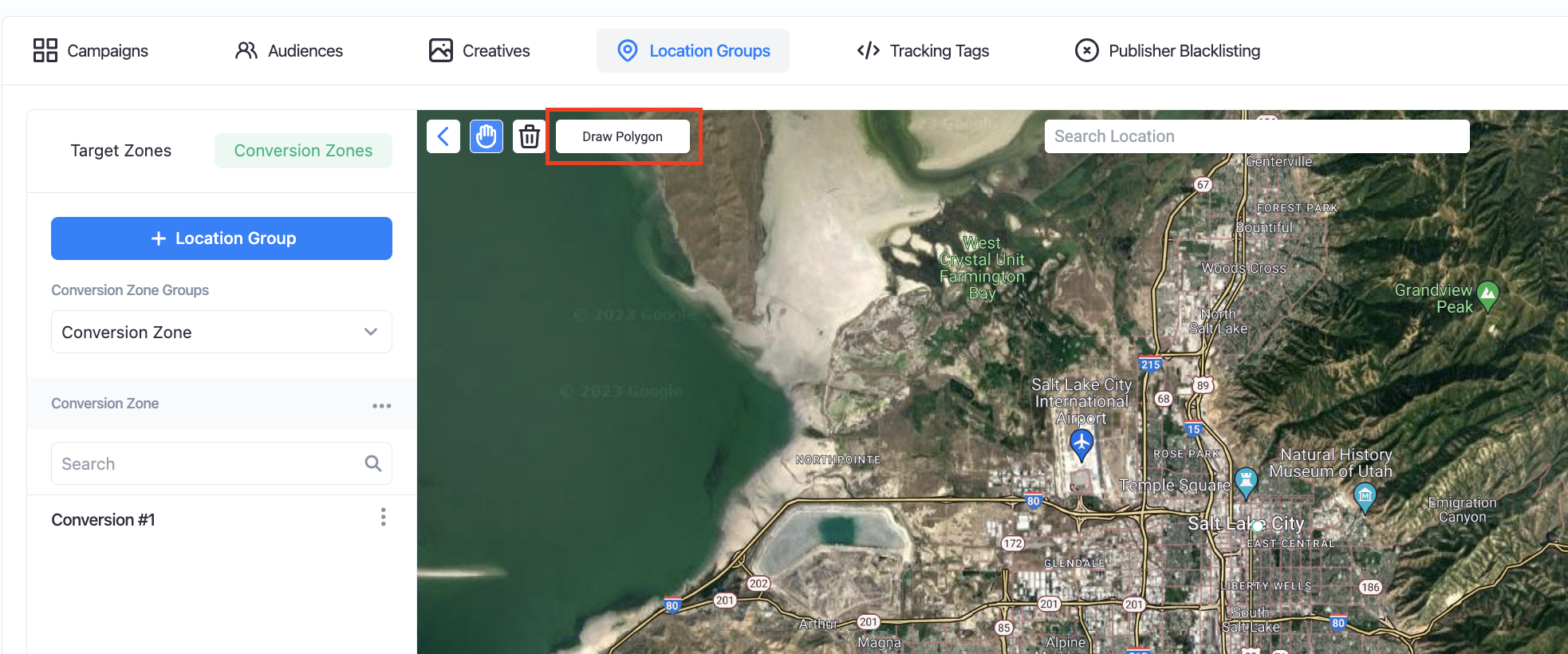
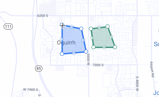
After drawing the conversion polygon, name your location and click "Create" to complete the zone.
Please Note that conversion zones will always display green, while target zones will always display blue.
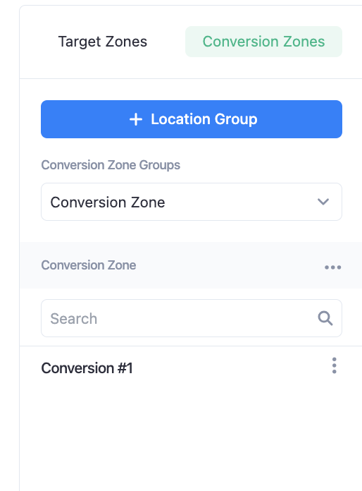
They are also listed below the map where you can view, rename, and delete zones by clicking on the 3 dots on the far right side of the table.
Did this answer your question?